|
The Manila Bay area was the focus, during the early phase of World War II, of a desperate
attempt to save the Philippines from Japanese conquest. In the Allied recovery of
the Philippines (1944-45), many Japanese ships were sunk in the bay.
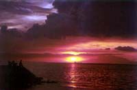
Situated on the western part of Luzon, Manila Bay is bounded by the provinces of Cavite in
the south, Metro Manila and Rizal in the east, Bulacan and Pampanga in the north, and
Bataan in the west and northwest. The bay has an area of approximately 1,700 sq km, a
length of 60 km, and widths varying from 22 km in the mouth to 60 km at the widest
portion. The average depth of the Bay is 17 m (volume = 30 x 109 cu m), and it
receives drainage from nearly 17,000 sq km of watershed composed of 26 catchment areas.
The Pasig River Basin (area of 9,000 sq km) and the Pampanga River Basin (area of 3,900 sq
km) make up more than 75% of the whole watershed. The Pampanga River contributes
approximately 49% of the net fresh water influx into the Bay, while Pasig River
contributes about 21%. The other river systems make up 26% of the freshwater source
and the remaining 4% comes from net precipitation over the Bay.
The human population of the cities and municipalities within the catchment areas is
constantly growing. Consequently, the organic pollution load into the Pasig River
and Manila Bay that comes from domestic wastewater has been its biggest threat.
|